| PalestineRemembered | About Us | Oral History | العربية | |
| Pictures | Zionist FAQs | Haavara | Maps | |
| Search |
| Camps |
| Districts |
| Acre |
| Baysan |
| Beersheba |
| Bethlehem |
| Gaza |
| Haifa |
| Hebron |
| Jaffa |
| Jericho |
| Jerusalem |
| Jinin |
| Nablus |
| Nazareth |
| Ramallah |
| al-Ramla |
| Safad |
| Tiberias |
| Tulkarm |
| Donate |
| Contact |
| Profile |
| Videos |
Welcome To al-Muwaylih - المويلح (אל-מוילח)
|
District of Jaffa
Ethnically cleansed days ago |
العربية Google Earth |
 |
Gallery (11) |
- Statistics & Facts
-
Before & After

- Satellite View
- Articles 4
- Pictures 11
- Aerial Views 1
- Oral History 2
- Members 5
- Families
- All That Remains
- Wikipedia
- Videos 2
- Guest Book 6
- Links 1
| Statistic & Fact | Value | ||||||||||||||||||
| Occupation Date | December 31, 1947 | ||||||||||||||||||
| Distance From District | 16 (km) Northeast of Jaffa | ||||||||||||||||||
| Elevation | 25 (meters) | ||||||||||||||||||
| Before & After Nakba, Click Map For Details |
|||||||||||||||||||
|
|||||||||||||||||||
| Map Location | See location #7 on the map View from satellite |
||||||||||||||||||
| Exodus Cause | Military assault by Zionist troops | ||||||||||||||||||
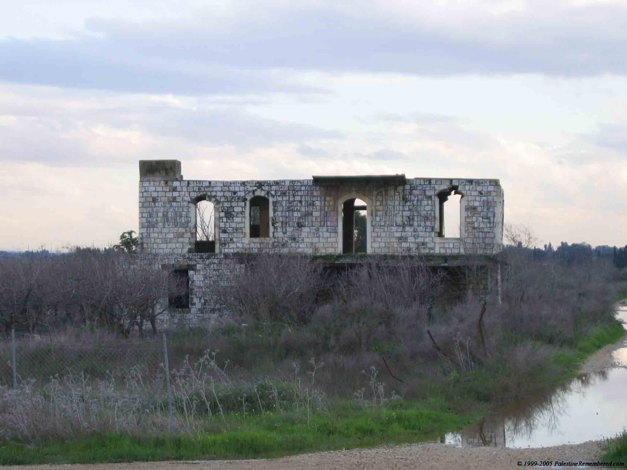
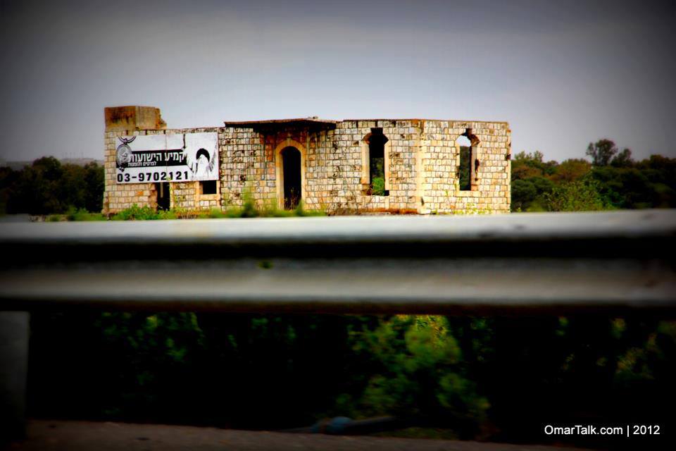
| Village Temains | Muwalih was mostly destroyed with the exception of few houses, one of which belongs to Halim al-Jayyusi. | ||||||||||||||||||
| Ethnically Cleansing | Late December 1947, Muwalih's inhabitants were terrorized into fleeing their homes. | ||||||||||||||||||
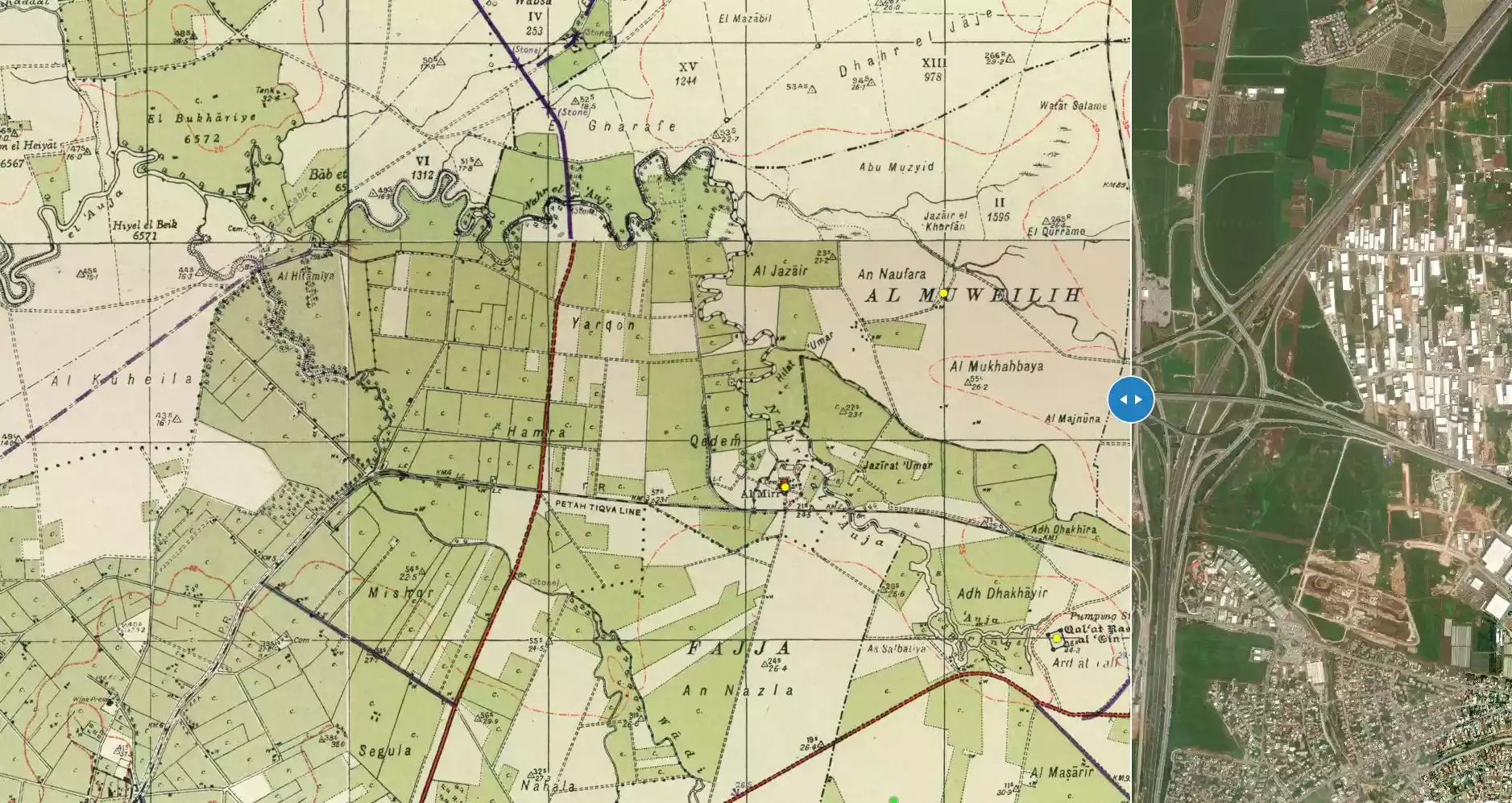
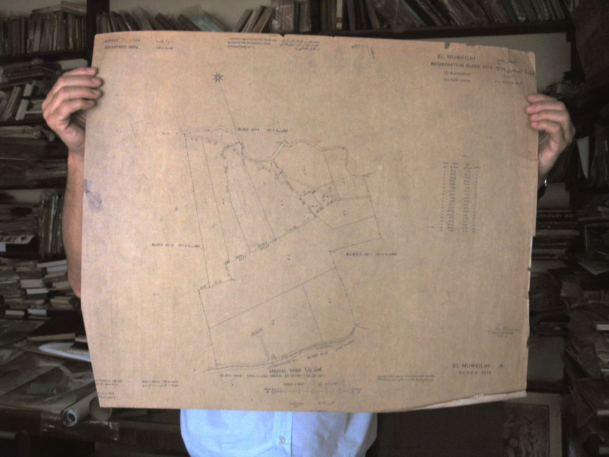
| Pre-Nakba Land Ownership |
**Town Lands' Demarcation Maps |
||||||||||||||||||
| Land Usage As of 1945 |
|
||||||||||||||||||
| Population |
|
||||||||||||||||||
| Inhabitants Place of Origin | al-Muwaylih was founded by nomads who traced their ancestry to the 'Arab al-Malaha Bedouin tribe. | ||||||||||||||||||
| Nearby Wadies & Rivers | al-Muwalih was situated 1.5 km north of the al-'Awja River | ||||||||||||||||||
| Water Supply | Muwalih had several wells located east of the village. | ||||||||||||||||||
| Exculsive Jewish Colonies Who Usurped Village Lands |
Newe Yaraq and the Palestinian Town of Jaljulya. | ||||||||||||||||||
| Featured Video | |||||||||||||||||||
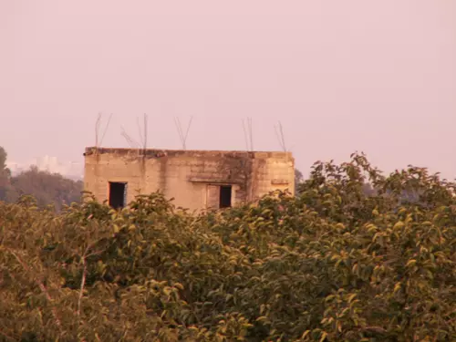
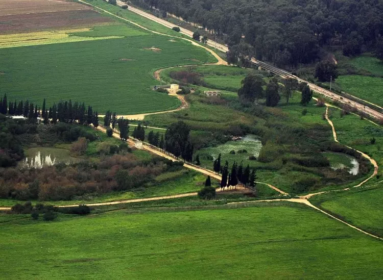
Village Before NakbaThe village was situated on the central coastal plain, 1.5 km north of the al-'Awja River. It was about 1 km east of a highway leading to Tel Aviv, Jaffa, and neighboring villages. The village was founded by nomads who traced their ancestry to the 'Arab al-Malaha Bedouin; they settled in the area, initially building their houses around a spring, and later along the road to Ra's al-'Ayn (a nearby village that was deserted at the beginning of this century). The village houses were laid out in no particular pattern. The population was predominantly Muslim. During the Mandate, large landowners built villas amidst the outlying citrus and banana groves. In 1944/45 a total of 949 dunums was devoted to citrus and bananas and 1,796 dunums were allocated to cereals; 27 dunums were irrigated or used for orchards. Wells on its east side provided irrigation water.Village Occupation and Ethnic CleaningIt is difficult to determine when the villagers were displaced, but the village was probably occupied relatively early, in the first weeks of 1948. Located in an area of heavy Zionist settlement northeast of Tel Aviv, the village would have been within easy reach of a Haganah or Irgun strike. In the period between late December 1947 and late March 1948, a significant number of villages in this area were emptied, generally as a result of direct attacks.Zionists Colonies on Village LandsThe settlement of Newe Yaraq (143171) was established in 1951, partly on village lands and partly on the lands of Jaljulya (a Palestinian village that still exists).Village TodayThe site is very difficult to identify. Some of the villas still stand, deserted, amidst wild vegetation. One of them belonged to Hashim al-Jayyusi, who later became a Jordanian cabinet minister. It is a two-storey, concrete structure with rectangular doors and windows and a stairway in front that leads to the second storey. The other villas have been reduced to rubble. The land in the area is cultivated.SourceDr. Walid al-Khalidi, 1992: All That Remains. |
|||||||||||||||||||
| Related Maps | Town Lands' Demarcation Maps خرائط للقضاء توضح حدود القرى والاودية Town's map on MapQuest View from satellite Help us map this town at WikiMapia |
||||||||||||||||||
| Related Links | Wikipedia's Page Google Search Google For Images Google For Videos |
||||||||||||||||||
| More Information | في كتاب كي لا ننسى في كتاب بلادنا فلسطين المزيد من موقع هوية |
||||||||||||||||||
- Village House In 1987
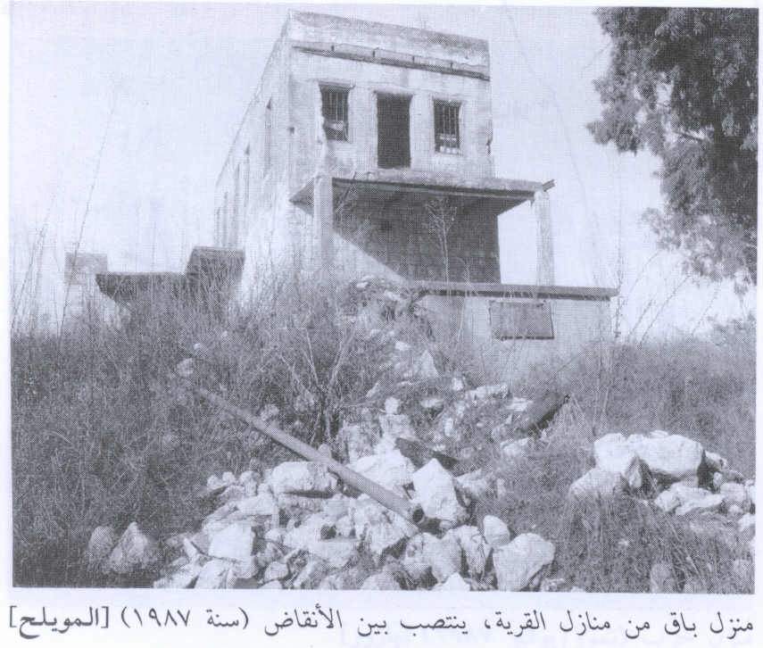
Scanned from "All That Remains" by Dr. Walid Khalidi 2 - A Two story structure remains standing in al-Muwaylih
Posted by Uri Zackhem 4 - One of the remaining al Muwaylih houses
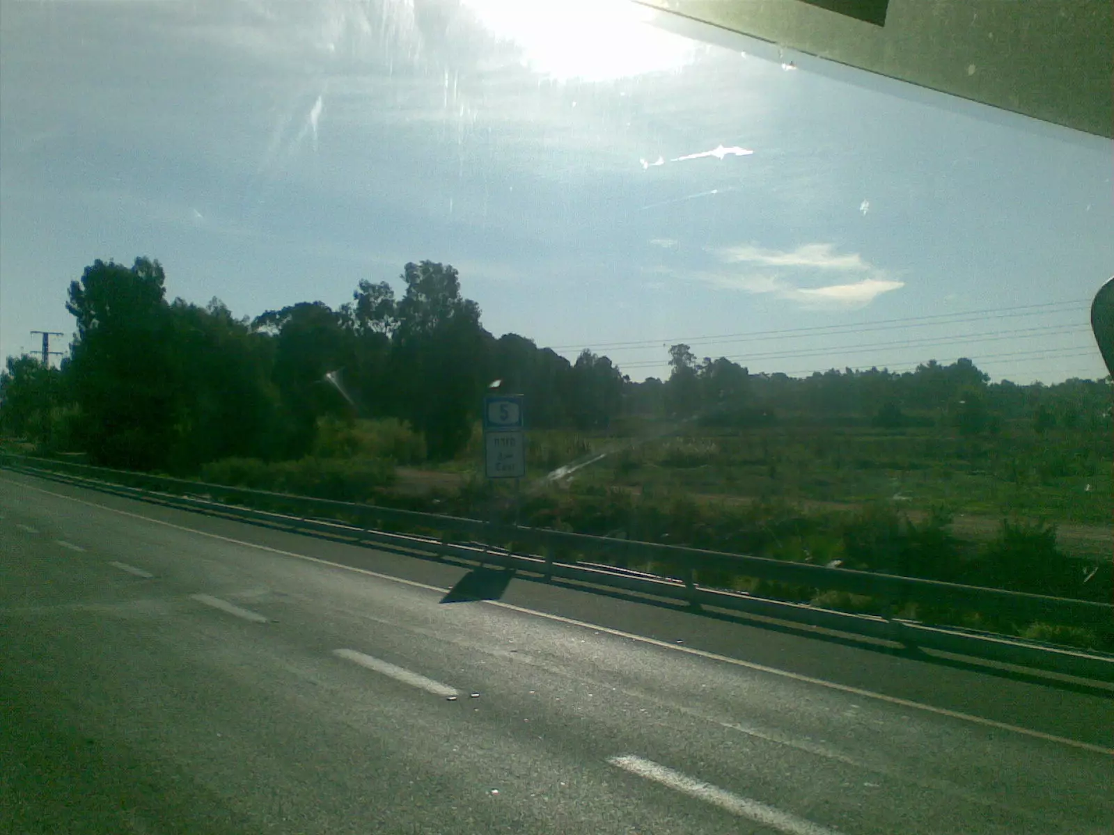
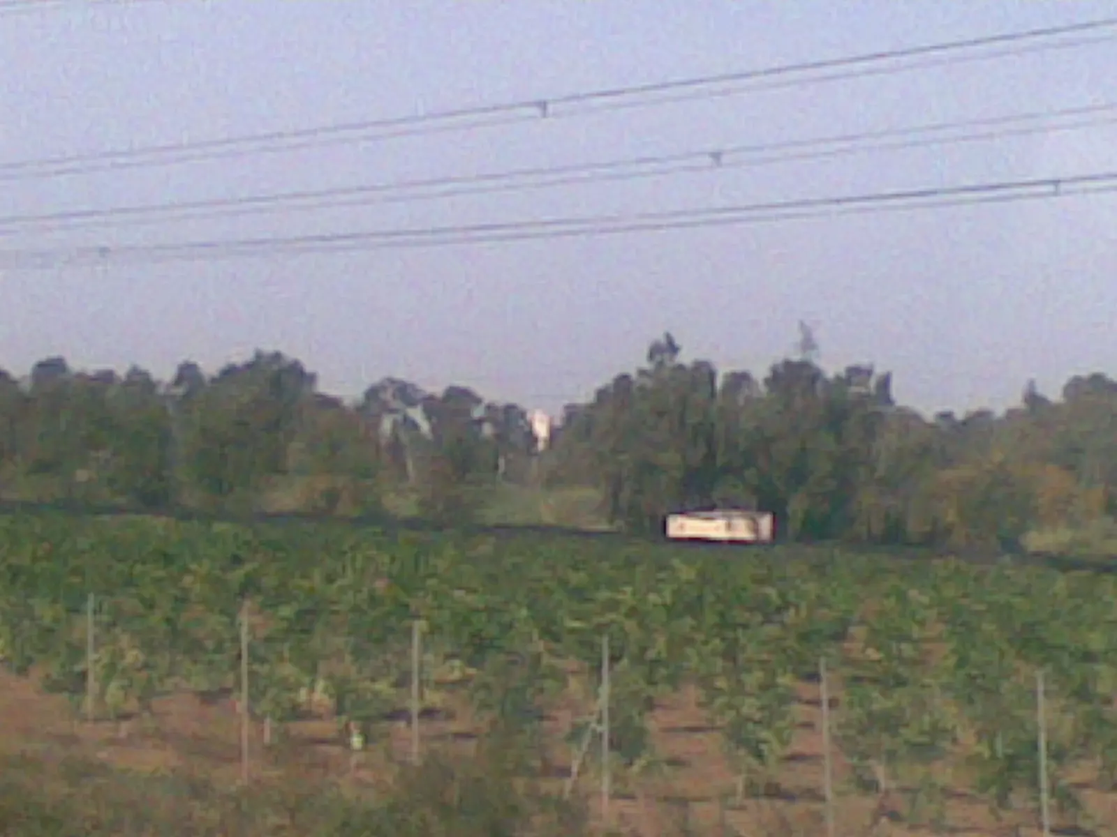
Posted by Uri Zackhem - صوره للمنطقه من على الطريق العام رقم 5
Posted by ابو الثائر - احد البيوت المتبقيه غربي اراضي القريه
Posted by ابو الثائر - اراضي تابعه للقريه من الجهه الغربيه
Posted by ابو الثائر - اراضي تابعه للقريه من الجهه الغربيه
Posted by ابو الثائر - al-Muwaylih (Map)
Posted by رحيلا مزراحي - أحد المنازل القائمة
1 - منظر عام للقريه
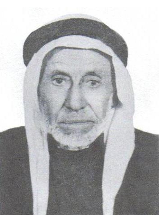
Posted by abu raya - المرحوم الحاج حسين الداقور - أبو إسماعيل
Posted by Ghanem Mustafa
Want to browse more? 80,000 pictures were grouped in these gallaries:
| Display Name | Clan/Hamolah | Country of Residence |
| ابو نضال | - | - |
| أبو عايش | أبو عايش | فلسطين, فلسطين |
| abu anas | aljaramneh | - |
| Hasan Alloush | Aljaramneh | - |
| جرامنه | ابووردة | - |
- Tracing all that remains of al-Muwaylih Duration: 56 sec
- الذاكرة مفتاح العودة-الحلقة 53- مويلح Duration: 23 min 22 sec
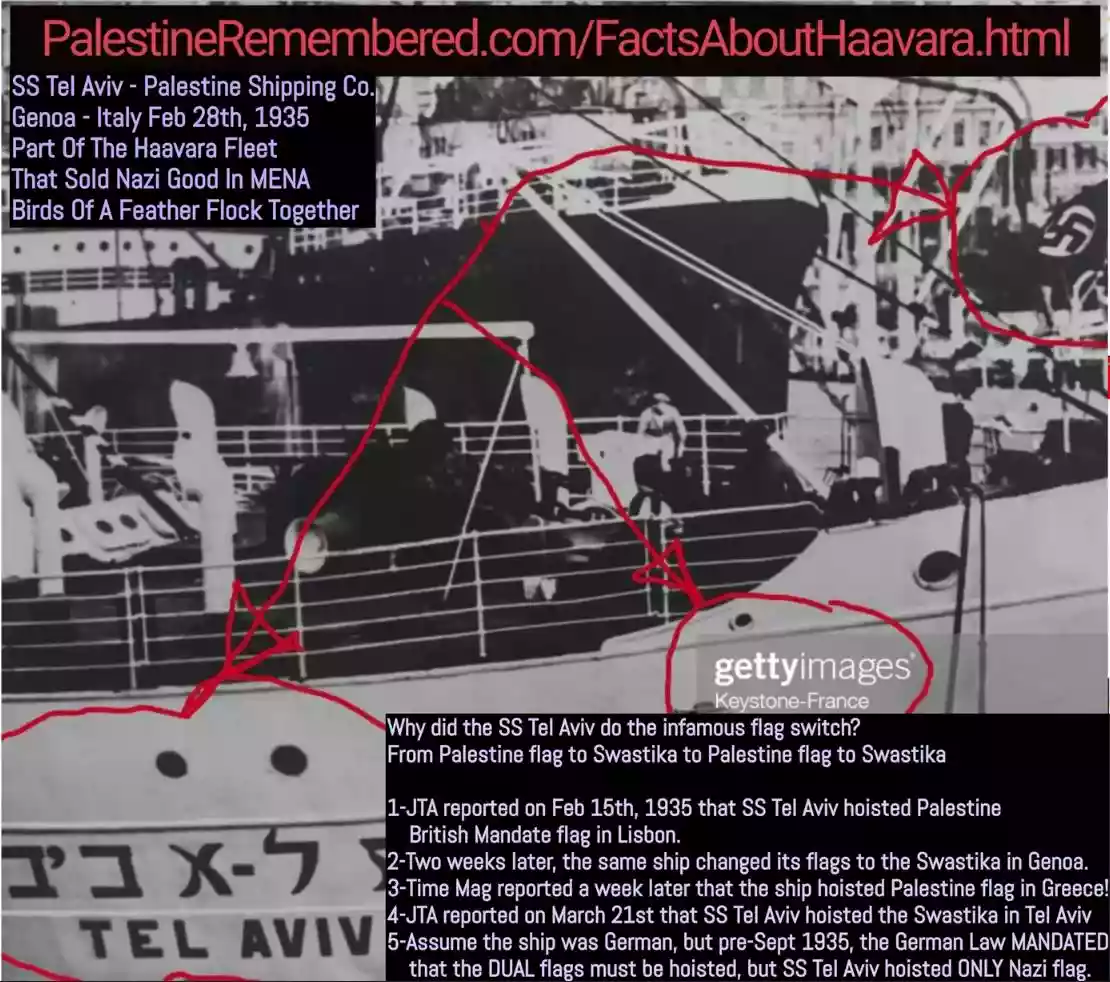 Fake Valor: Why Did Zionist Jews Hoist Nazis Flag on Their Ships in the 1930s?
What is new?
-
Facts About Oct. 7th Gaza Raid
-
Remined Us Please:: Who Did Rape Who? Palestinians Raped Israelis? Or, was the other way around?
-
When Prof. Edward Said was invited to debate Bibi Netanyahu in the 1980s, watch what happened!
-
Ezra Klein of the NY Times on the "Jewish Race".
-
Abusing Blood Libel!
-
Did Israeli Soldiers Activate The Hanniba Direective On Oct. 7th? You Be The Judge
-
Zionist FAQ: Isn't it true that Palestinians don't want peace? Palestinians never accepted the two-state solution
- Facts about Haavara (Transfer) Agreement between Ben-Gurion & Hitler
-
Haavara FAQs: Why Did Zionist Jews Hoist Nazis' Flags on Their Ships in the 1930s?
- Haavara FAQs: When Chaim Weizmann met FDR in mid-1943, why was he silent about rescuing European Jewry?
-
Dear ChatGPT: How did Palestinians resist Napoleon's invasion of their country in 1799?
-
Dear ChatGPT: Gaza had a vibrant Jewish community in the mid-17th century. What happened to them?
-
Dear ChatGPT: Why did the Jewish Agency suppress news of the Holocaust during WWII?
-
Video Playlist: Jews share their DNA tests to end the conflict for good.
-
A Tale of Two Conflicts: Examining the Definition of Genocide
-
Prof. Abraham Polak And The Suppressed History of the Khazars and European Jewry
-
How Ronald Reagan would have framed the genocide in Gaza if he were still alive?
-
Haavara FAQs: Let us do the math: how many German Jews did The Haavara Agreement save?
-
Zionist FAQs: The Hebron Massacre of 1929, "clearly proves" that Palestinians are antisemitic, how could you deny it?
-
Zionist FAQs: Why Anti-Zionist Is Not Antisemitism?
-
Zionist FAQs: Isn't it true that the KGB created Palestinian Nationalism in the early 1960s?
- Zionist FAQs: Muslims are killing Muslims all the time; why are Israeli Jews being singled out in the media?
- Zionist FAQs: How is Israel an apartheid state when 20% of its citizens are Arabs who enjoy full rights?
-
Haavara FAQs: Why Did Dorothy Thompson Flip From A Zionist Advocate to A Silenced Dissenter?
-
Haavara FAQs: Analysis of Herzl's Uganda Scheme and how it could have saved millions of Jews.
-
Haavara FAQs: Why did Hayim Greenberg describe American Jewry as "morally bankrupt" in early 1943?
-
Haavara FAQs: What if the Evian Conference was a resounding success? What would have been the impact of saving European Jewry on Zionism?
- Haavara FAQs: What if the six million were saved, how that would have impacted the Zionist project?
-
Haavara FAQs: How did Zionist leaders react when Europe's Jews lingered in the DP camps after WWII ended?
-
Why does the American Jewish community repeat lies that David Ben-Gurion had debunked before he died?
-
Who has the power to rename the Tatar/Khazar Gene Marker to Jewish IV?
-
Zionist FAQs: Why won't Egypt, Syria, and Jordan take their people back? Jews are indigenous to Palestine, and Arabs immigrated after Jews developed the country. Arabs should leave.
-
Haavara FAQs: Did Hitler and the Nazis conflate between Judaism and Zionist? If that wasn't case, then why?
-
Haavara FAQs: Winston Churchill and antisemitism, a collection of articles written Churchill.
-
Haavara FAQs: Broken by country, how many Jews survived vs. killed during the Holocaust?
-
Haavara FAQs: Why did European Jews vote with their feet and to immigrated to the Americas, not Palestine, after WWII?
-
Watch this American Jewish Girl describing Israeli Jews' cognitive dissonance like no other in under two minutes
-
Haavara FAQs: When the Nazis went out of their way to hide the Holocaust, Israeli Jews did the exact opposite by broadcasting their genocide of Gazans. But why?
-
Haavara FAQs: How Zionist Jews went out of their to show their appreciation to Nazism and Fascism?
- Haavara FAQs: Why Zionist leaders were against bombing the death camps & the Railroads leading to them?
-
Haavara FAQs: Hitler's message to the British and American people: If Jews are such noble citizens and you care about them, how come you're not letting them in? I will gladly ship them to you at my expense, even on luxury liners!
-
A shortlist of Zionist and Israeli false flag operations in the name Jews.
-
The Most Moral Army
- The Land of Kapos (Israel): Where the brave are boycotted and Kapos walk free.
- Why did early Zionists often named their communal enterprises "colonial"?
- Zionist Relations with Nazi Germany by Faris Glubb
-
Two NY Times advertisements by Zionists in the early 1943 that exposes Zionists' treason at the height of the calamity
- Facts Not Lies about the Palestinian-Israeli Conflict.
- Site's pictures have been categorized
- Campgain Against Lice
- A Survey of Palestine, the official source about Palestine before Nakba produced by the British Mandate; over 1200 pages.
- Satellite View & Google Earth: Over 6,000 placemarks identifying all destroyed towns, W. Bank & Gaza Strip Towns, & refugee camps.
- PalestineRemembered.com and its Nakba Oral History Project were featured on al-Jazeera Satellite TV.
- Nakba Oral History Video Podcast:
 Over 700 Oral History interviews (including 3,500+ hours of recording) can be viewed online.
 - Palestine Village Statistics Project
- Gaza Jail Break
- النسخة العربية للموقع الان متوفرة
- Videos: Documenting the destroyed villages in video: Tracing all that remains since Nakba.
- Videos: Responding to Zionist Propaganda
- Interview: The ethnic cleansing of Palestine: George Galloway interviews Israeli Historian Ilan Pappe.
- For Palestinians, memory matters. It provides a blueprint for their future By George Bisharat.
- Zionist FAQ now available in Hebrew שאלות שציונים שואלים, עכשיו בעברית
- Video: The Stephen Walt and John Mearsheimer report on the influence of the Israel Lobby on U.S. Foreign Policy
- The Palestinian-Israeli conflict for beginners